A heatmap using data compiled from a fitness app shows where Chicagoans like to run and take their bikes: in the city’s big parks and along streets that cut across the grid system.
Unveiled in recent months, the map from Strava spans the globe (even on military sites) and is built on one billion activities logged by Strava users who’s movements are tracked by the app.
The heatmap uses bright colors to show popular routes in Chicago, confirming not only how much people like to run and bike along the city’s Lakefront Trail, but also what other parts of the city are popular.
As Curbed points out, the Chicago Marathon route is clearly visible on the heat map as one of Chicago’s most popular running, at least for those tracking their activity using Strava. It is unclear how many of the race’s 45,000 participants used the app.
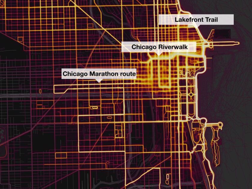
The map below shows popular (and less popular) roads and trails to run on around Downtown. Notable here are the marathon route, Lakefront Trail and the Chicago Riverwalk.
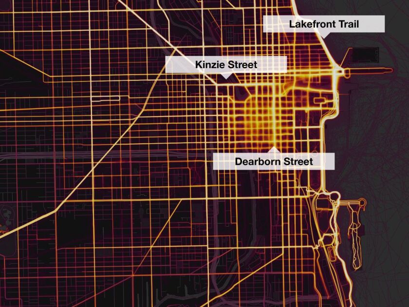
Popular Downtown biking routes are slightly different, with dedicated bike lanes along Kinzie and Dearborn street proving popular.
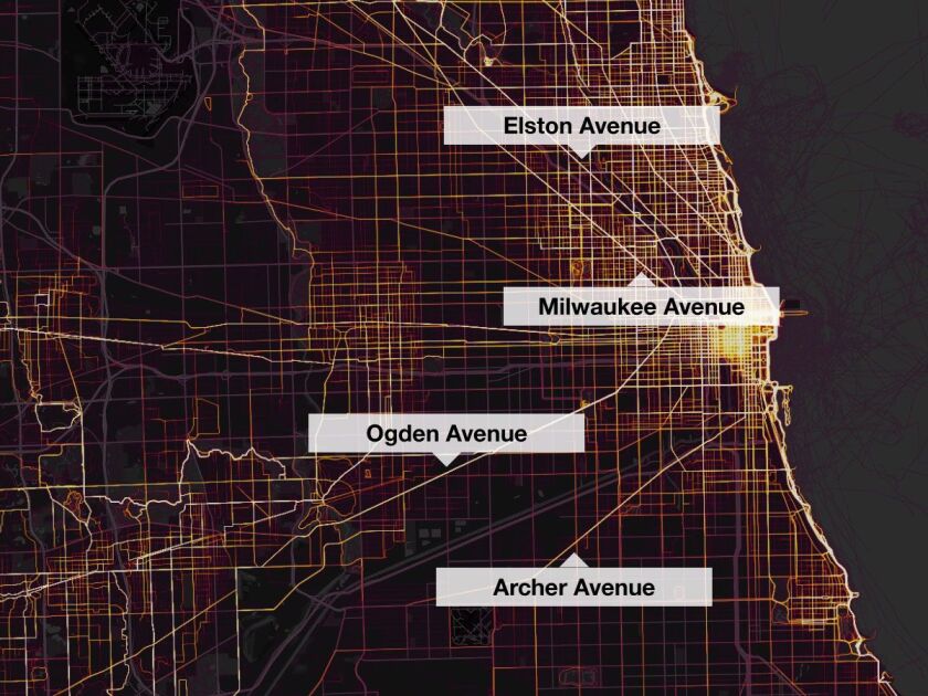
Zooming out to the rest of the city, biking and running is popular in the city’s parks. Here’s the bike map, showing the popularity of roads like Elston, Milwaukee, Ogden and Archer avenues, all of which cut diagonally across the city’s grid system.
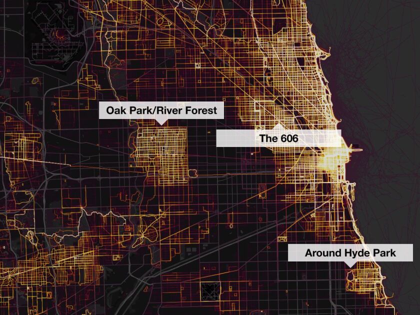
The running map shows people criss-crossing the North Side, the city’s big parks, Hyde Park and the nearby western suburbs of Oak Park and River Forest. There’s even a faint bit of running at O’Hare Airport.