
The Chicago area is bracing for two cold snaps with windchills possibly as low as 30 degrees below zero as well as more snowfall over the next week, according to the weather service.
As of 7 a.m. Friday, O’Hare Airport was reporting temperatures that were 6 degrees below zero and Midway Airport was seeing minus 4, the National Weather Service said. With windchill factored in, temperatures at both airports were minus 25.
In some parts of northeast Illinois, windchill values could dip to minus 30 Friday morning, the NWS said. As the day warms up, temperatures will only climb to highs in the single digits.


There also will likely be snow starting in the late afternoon, snarling rush-hour commutes, the weather service said. Those in the Chicago area should expect up to 2 inches of accumulation.
The NWS said that by late Sunday, a “shovel-able” amount of snowfall was predicted to return, following last weekend’s winter storm that led to a thousand flights canceled. Amounts greater than 6 inches are possible.
The snowstorm will help things warm up a bit — temperatures Monday should climb into the 20s but will drop back to below zero by Tuesday, when another arctic front may bring some of the lowest temperatures we’ve seen since January 2014.
A windchill of minus 30 or lower will settle in from Tuesday to late Thursday, the NWS said. Wednesday’s highs will likely remain below zero.
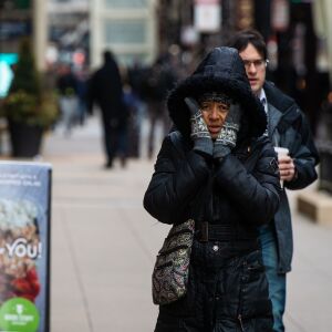
The weather service noted that the low temperatures and windchills could cause frostbite on exposed skin in as little as 30 minutes. Anyone going outdoors during the extreme cold should wear a hat and gloves to reduce the risk of frostbite and hypothermia.
City, county and state warming centers are available for residents who need to get out of the cold.
The NWS also warned that road salt may be less effective in the bitter cold during Friday evening commutes, as the snow may stick and cause slick spots.
Bitterly cold air will be the rule for the next 5 days. A quick round of light snow will occur this afternoon into the evening, with up to an inch or two of accumulation possible. Besides the cold, there is a potentially significant snow system arriving late Sunday night. pic.twitter.com/6uIs9mFxW5
— NWS Chicago (@NWSChicago) January 25, 2019
The sun is out, but don't be fooled by the sunshine, it is dangerously cold out still. Wind chills at 8 am remain between 15 and 30 degrees below zero! If you have to go outside, bundle up and wear layers! pic.twitter.com/8br3pfk1eY
— NWS Chicago (@NWSChicago) January 25, 2019


